
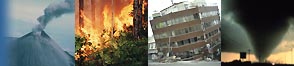
Colorado Wildfires 2002
Charles Benight
Department of Psychology
University of Colorado
Colorado Springs, CO 80933
Eve Gruntfest and Kelly Sparks
Department of Geography and Environmental Studies
University of Colorado
Colorado Springs, CO 80933
Charles Benight: benight@uccs.edu
Eve Gruntfest: ecg@uccs.edu
Kelly Sparks: ksparks@uccs.edu
This QR report is available in its entirety only in PDF format. The entire report includes
the survey questionnaire. Below you will find the introduction, methodology, summary, and references.
This material is based upon work supported by the National Science Foundation under Grant No. CMS-0080977. Any opinions, findings, and conclusions or recommendations expressed in this material are those of the author(s) and do not necessarily reflect the views of the National Science Foundation or the Natural Hazards Research and Applications Information Center.Citation: Charles Benight, Eve Gruntfest, and Kelly Sparks. 2004. Colorado Wildfires 2002. Quick Response Research Report #167. Boulder, Colorado: Natural Hazards Research and Applications Information Center, University of Colorado. URL: http://www.colorado.edu/hazards/qr/qr167/qr167.html.
More than 5,000 individuals were evacuated because of the catastrophic 2002 Colorado wildfires. Many of the individuals who were evacuated were kept from their homes for up to a month. Many homes were lost to the fire. This report addresses the actions people took and perceptions people had of the fire during the evacuation period. The questionnaire we used is provided at the end of this report.
The primary aims of this project were to determine:
- The roles of new public and private sources of warning information for wildfire disasters in public response to warnings;
- The importance of changing population demographic characteristics on types of warnings utilized and public responses enacted;
- The utility of technological outlets for warnings and technological advances for spatial data use from Geographical Information Systems, (GIS);
- The value of conventional wisdom for false alarms and warning lead-times on public perceptions of warnings; and
- The predictive utility of social cognitive theory to help understand evacuation behavior and coping outcomes.
Study Area
The study area consisted of the regions affected by the two major Colorado wildfires of 2002, the "Hayman" fire and the "Missionary Ridge" fire, shown in Figure 1. The Hayman fire burned 138,577 acres thirty miles southwest of Denver; the Missionary Ridge fire burned 72,964 acres north and northeast of Durango, Colorado (USDA Forest Service, 2002). Most of the area of both these fires lies in National Forest.
Sample
The sample consisted of 109 individuals who were within an evacuation area during the fires. The average age of the people in the sample was 53; 59% were female. The median annual income was between $55,000 and $65,000. The majority of people surveyed were college graduates. As would be expected based on the demographics of rural Colorado, almost the entire sample was Caucasian (93%). Thus, virtually no information is available from this sample on minority populations. Sixty-two percent of the individuals in the sample reported being married. There was a wide range in the length of residency in a wildfire-prone area for people in the sample: from 3 months to 53 years. Time in present home ranged from less than 1 year to 45 years with a mean of 11 years. Of the sample, 82% reported owning their home. Only seven of the individuals who responded indicated that their home had been destroyed by the fire. Thus, the majority of this sample experienced evacuation and were able to return to their homes. Approximately two thirds of the sample reported no damage to their home from the fire. In relation to proximity of the fire to the home, half of the sample indicated the fire was within one mile and the farthest distance reported was 8 miles. Only 6% of the sample indicated that they had received mental health counseling for problems related to the fire.
- Supporting earlier findings from Dow and Cutter (1998), most of our respondents (N=104) used a combination of information on the fires from a variety of sources. Over 75% used more than one source for their information on the fire.
- Survey participants with a longer time of residency believed that their property would be safer than newer residents. Females reported that it was significantly harder to leave their home because of love for the forest. Females also indicated significantly greater trust in governmental warnings and evacuations in relation to fire hazards.
- Roughly half the respondents believed they had enough information and the other half reported there was not enough. The information that participants most needed was accurate, detailed, and up-to-date maps of the fire's exact location in relation to homes. The Internet was an important source for this kind of information, though some evacuees lost access to this medium upon leaving their homes.
- Officials have often worried that false alarms reduce willingness to take protective action in later warnings. We asked if our respondents had previous experiences with false alarms. Most reported previous experience with false alarms had little effect on their decision whether or not to evacuate this time, and earlier lessons learned may have even helped them in the evacuation process.
- Higher coping self-efficacy (CSE) for evacuating was correlated negatively with the amount of time reported for evacuation. CSE for evacuating was also found to be a significant predictor of posttraumatic stress symptoms experienced after the fire even after controlling for amount of lost resources suffered in the fire and how close the fire came to their home. Social cognitive theory may provide a useful framework for studying the warning process.
Dow, K. and S. L. Cutter. 1998. "Crying Wolf: Repeat Responses to Hurricane Evacuation Orders." Coastal Management 26:237-252.
Finney, M.A., R. Bartlette, L. Bradshaw, K.Close, P. Gleason, P. Langowski, C.W. Mchugh, E. Martinson , P. N. Omi, W. Shepperd, K. Zeller. 2002. Interim Hayman Fire Case Study Analysis: Report on Fire Behavior, Fuel Treatments, and Fire Suppression http://www.fs.fed.us/rm/hayman_fire/text/02finney/02finney.html.
GeoMac Wildland Fire Support. Geospatial Multi-Agency Coordination. Accessed 2002, 2003. http://www.geomac.gov/. Hayman Fire Case Study Analysis: Executive Summary Rocky Mountain Research Station USDA Forest Service Fort Collins, Colorado http://www.fs.fed.us/rm/hayman_fire/text/01exe_summ/01exe_summ.html.
Summary of the Hayman Fire, Colorado. June 8 - July 2, 2002, Wilderness Society Denver. http://www.wilderness.org/Library/Documents/WildfireSummary_Hayman.cfm. USDA Forest Service. 2002, BAER (Burned Area Emergency Rehabilitation Reports) Missionary Ridge Fire Colorado http://www.fs.fed.us/r2/sanjuan/bulletin_board/MR.htm.