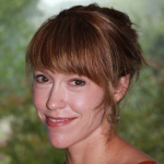
 Jacqueline Curtis
Jacqueline W. Curtis is the Associate Director of the GIS | Health & Hazards Lab and Assistant Professor in the Department of Geography at Kent State University. Dr. Curtis studies post-disaster recovery and planning as they impact the health of mothers and children. Her current projects focus on the use of geospatial technologies and spatial analysis to map and assess use and perception of physical activity environments for children in derelict neighborhoods. More broadly, she is interested in the role of women in shaping healthy neighborhood environments in the aftermath of disasters, especially in the American South.
Dr. Curtis holds a Ph.D. in Geography from Louisiana State University (LSU). She has served as a faculty member at LSU in the Disaster Science and Management Program, as well as in the Departments of Geography at the University of Southern California (USC) and California State University Long Beach (CSULB). She is an Editorial Board Member and Book Review Editor for the journal, Cartography and Geographic Information Science (CaGIS), as well as a recipient of the Association of American Geographers’ Meredith F. Burrill Award.
Please see the following links to her faculty biographical sketch to and the GIS Health & Hazards Lab at Kent State University.
Workshop Abstracts
Spatial Patterns of Post-Wildfire Neighborhood Recovery: A Case Study from the Waldo Canyon Fire (Colorado Springs, Colorado, 2012)
Related Resources from Jacqueline Curtis
Geospatial Video for Field Data Collection
With
Andrew Curtis, Barrett Kennedy, S. Wright Kennedy, and Jay D. Edwards
Applied Geography, 2010
