
Collection of Satellite-referenced Building Damage
Information in the Aftermath of Hurricane Charley
Beverley J. Adams
Michael Z. Mio
ImageCat, Inc.
400 Oceangate, Suite 1050
Long Beach, CA 90802
J.Arn Womble
Kishor C. Mehta
Wind Science and Engineering Research (WISE) Center
Texas Tech University
Box 41023
Lubbock, Texas, 79409
This QR report is available in its entirety only in PDF format. Below you will find the introduction, future work, key findings, and acknowledgements.
This material is based upon work supported by the National Science Foundation under Grant No. CMS-0080977. Any opinions, findings, and conclusions or recommendations expressed in this material are those of the author(s) and do not necessarily reflect the views of the National Science Foundation or the Natural Hazards Research and Applications Information Center.Citation: Beverley J. Adams, J. Arn Womble, Michael Z. Mio, John B. Turner, Kishor C. Mehta and Shubharoop Gosh. 2004. Collection of Satellite-referenced Building Damage Information in the Aftermath of Hurricane Charley. Quick Response Research Report #168. Boulder, Colorado: Natural Hazards Research and Applications Information Center, University of Colorado. URL: http://www.colorado.edu/hazards/qr/qr168/qr168.html.
Note: This field campaign, undertaken in the aftermath of Hurricane Charley, was funded by the National Science Foundation, the Natural Hazards Research and Applications Information Center, and the Multidisciplinary Center for Earthquake Engineering Research (MCEER). It presented the research team with a unique opportunity to collect perishable damage survey data that will support subsequent research aimed at improving the effectiveness of disaster response activities using satellite remote sensing technology.
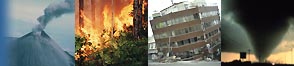
Hurricane Charley was the most severe windstorm to strike the US since 1992. Making landfall on August 13th 2004 at 4pm ET, 145mph winds devastated the Florida coastal cities of Port Charlotte and Punta Gorda, and 10ft high waves wreaked havoc on nearby barrier islands. In the hours following, a Presidential disaster declaration was issued for twenty-five counties in the impacted region. The event resulted in the loss of at least 27 lives, and caused more than $15.4 billion of damage.
This event is the first Category 4 hurricane for which 'before' and 'after' satellite imagery is available from very high-resolution systems, such as Quickbird and IKONOS. From a scientific perspective, it therefore offers a unique opportunity to investigate the use of remote sensing for post-disaster urban damage assessment, technology which has the potential for improving the effectiveness of disaster response activities.
In order to validate building damage characteristics identified on the satellite imagery, corresponding ground-based observations are required. There is a narrow time window for documenting the building and infrastructure damage from extreme windstorm events, as clean-up operations are typically initiated as soon as possible. Through funding from the National Science Foundation Small Grants for Exploratory Research (SGER) program and the Natural Hazards Research and Applications Information Center Quick Response program, two field reconnaissance trips have been conducted by ImageCat in conjunction with the Wind Science Research and Engineering (WISE) Research Center at Texas Tech, to collect perishable damage data using the VIEWS (Visualizing Impacts of Earthquakes With satellites) system, which was developed by ImageCat through funding from MCEER (Multidisciplinary Center for Earthquake Engineering Research). It is envisioned that the data collected will ultimately form the basis of research activities extending the application of post-disaster damage assessment methodologies and algorithms developed for earthquake to multiple hazards. This research will result in significant advances for windstorm engineering.
The following preliminary report begins with a brief overview of the field study sites, together with satellite imagery that was available. It goes on to document damage survey activities that were conducted, together with the methodologies and sampling strategies employed for data collection. A summary is given of the resulting data sets, and a selection of illustrative examples presented, which were extracted using the MCEER-funded D-VRS (Virtual Reconnaissance System) system. The report concludes with a list of key findings and lessons learned.
The data collected during this field campaign constitute a valuable resource for future collaborative research activities by ImageCat Inc. and Texas Tech University, which aim to improve the effectiveness of disaster response activities through the use of satellite remote sensing technology. Funding will be sought from the National Science Foundation to support these activities. The August 2004 field deployments to Florida also provide valuable feedback for augmenting and improving the VIEWS field reconnaissance and D-VRS data integration and visualization systems. These refinements, and their associated benefits for future multi-hazard field reconnaissance, will be supported by MCEER funding.
The acquisition of field damage data is significantly accelerated and streamlined using the MCEER-funded VIEWS (Visualizing Impacts of Earthquakes with Satellites) reconnaissance system. Whereas traditional surveys on foot cover approximately 20-100 structures per day, the vehicle-based VIEWS survey captured a GPS-linked photographic record, together with detailed video footage of building damage for ~2,500 structures per day.
High-resolution optical satellite imagery collected by commercial systems such as Quickbird provides a detailed overview of building damage caused by Hurricane Charley. Exploratory visualization using the MCEER-funded D-VRS (Desktop Virtual Reconnaissance System) system suggests that different types and extremes of damage can be detected to residential, commercial/industrial and government structures. This information will support subsequent research activities that aim to improve the effectiveness of disaster response activities using remote sensing technology.
A time window spanning several weeks was available for perishable field data collection in the aftermath of this category hurricane. However, the type of damage that could be viewed varied as time progressed. For neighborhoods of family dwellings, fallen trees and scattered debris was cleared within the initial 1-3 days following the storm. After 4-5 days, roof damage to some of these properties was obscured by tarps. By the second week, there was a significant increase in the number of covered roofs, for which damage characteristics could no longer be recorded. Roof repairs were also underway at this time. When compared with the remote sensing imagery, these roofs will now exhibit fundamentally different visual characteristics. Clean-up operations proceeded far more slowly in mobile home parks. Scattered debris was still evident in the second week, and few properties were either tarped or undergoing repair.
Extensive damage was sustained by the power system. In the week following the hurricane few stop lights were working and few businesses operating. Roads remained blocked by fallen power lines and broken poles. During the second week, progress was clearly being made with the repairs. Roads were instead obstructed by repair crews and some businesses had reopened. The signature of power system damage on remote sensing imagery is a topic for future research.
The field reconnaissance activities described here were funded through support from the National Science Foundation Small Grants for Exploratory Research program (SGER grant number 0454564), the Natural Hazards Research and Applications Information Center Quick Response program and the Multidisciplinary Center for Earthquake Engineering Research. The support and guidance of Dennis Wenger and Steve McCabe at NSF, Kathleen Tierney at the Natural Hazards Center and Michel Bruneau at MCEER are gratefully acknowledged. The authors would also like to thank Brett Thomassie and Caroline Colvin at DigitalGlobe for processing and delivering the satellite imagery on a tight time schedule.
Opinions, findings, conclusions and recommendations expressed in this report are those of the authors and do not necessarily reflect the views of the National Science Foundation, Natural Hazards Research and Applications Information Center, or the Multidisciplinary Center for Earthquake Engineering Research.