 A U.S.Geological Survey hydrologic technician measures flooding caused by Hurricane Florence in North Carolina. ©Laura Lapolice, U.S. Geological Survey, 2018.
Weather events are more extreme, more people live in the path of more serious disasters, and each year, the financial costs of recovery and mitigation skyrocket. In short, we live in a riskier world.
This is often referred to as the “new normal,” but the fact is that in the spectrum of disaster risk, there will never be a normal. In this ever-changing environment, the agencies that help societies withstand disaster impacts are increasingly realizing that they need to have nimble processes in place to be effective. The U.S. Geological Survey is one of them.
USGS has recently released a strategic plan that will make the bureau’s research and products—which include scientific observations, warnings, and hazards and loss assessments—more usable to those addressing disaster risk. A plan report, Science for a Risky World, outlines new ways USGS can incorporate a risk-focus into their work and also sets out recommendations and potential projects.
As with many USGS projects in the past few years, the plan stresses getting stakeholder feedback at every stage of project development, from concept to evaluation. We asked report coauthors Kristin Ludwig and Dave Ramsey to give us some highlights of the plan and how it will benefit professionals who rely on USGS products to manage disasters.
What philosophies drove the U.S. Geological Survey to create this plan?

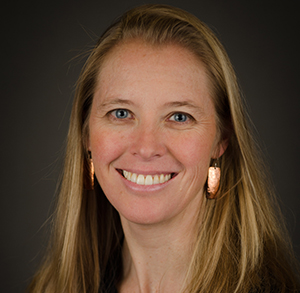
Kristin Ludwig, USGS Staff Scientist
At the heart of this plan is the natural hazards mission of the USGS, which is to develop and apply science to help protect the safety, security, and economic well-being of the nation. Specifically, this plan came about as an outgrowth of the USGS Natural Hazards Science Strategy published in 2013.
The strategy identified risk as “an integral part of hazards science” and described the USGS commitment to ensure that our hazards information is incorporated into vulnerability and risk analyses and delivered in forms that can be effectively used by decisionmakers.

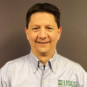
Dave Ramsey, USGS Geologist.
An additional driver has been the success of efforts like PAGER alerts and the ShakeOut, ARkStorm, and HayWired scenarios, which demonstrate the power of creating products in partnership with stakeholders that support decisionmakers in assessing risk and communities in risk mitigation planning. This plan addresses the need to grow USGS risk research and applications across a broad range of hazards to provide actionable information for risk reduction to our partners.
Hasn’t the U.S. Geological Survey always provided hazards monitoring and assessment information to U.S. communities? How is this effort different?
Yes—we have and will continue to provide hazard monitoring information to United States and even to global communities using our seismic and volcano monitoring networks, our coastal change analyses that assess impacts from major storms, our invasive species monitoring, and our stream gage network, which supports the National Oceanic and Atmospheric Administration’s flood and severe weather warnings.
The Risk Plan emphasizes the next step in providing this information—we know a hazard might occur in a particular location, but what’s at stake? How might livelihoods, economies, and communities be disrupted by such an event? And how can we effectively combine our understanding of the physical processes of these hazards with the anticipated social consequences to better safeguard communities? This plan is intended to identify the ways that we as an agency can advance our ability to deliver information to reduce risk.
Although the plan is primarily geared toward U.S. Geological Survey efforts to advance risk assessment and applications, it heavily emphasizes building collaborations with external partners. How would social scientists, policymakers, and state and local emergency decisionmakers benefit from becoming familiar with this plan?
One of the tenets of the plan is an emphasis on communication with partners before, during, and after the development of our products. The USGS has a rich tradition of working with partners at local, state, federal, and international levels. What is unique about this plan, is that it identifies our needs to advance our capabilities in developing products and tools to inform risk reduction.
For example, in some cases, we know that we will need input from sociologists, economists, and communicators. In other cases, we may need to augment our work with visualizations. In yet other cases, we will need to evaluate existing products from a user perspective to improve the next generation product. Because the USGS does not necessarily have this expertise in-house, we will be looking to external colleagues to collaborate on these efforts going forward. By familiarizing themselves with the plan, these partners can better play a role in helping us create future products.
One of the recommendations of the report is to create a community of practice for those working in areas of disaster risk. What would that look like and how do you see it benefitting the stakeholders mentioned above?
In developing the plan, we recognized we needed a way to engage the many different parts of the USGS that are making contributions to risk reduction. We also wanted to create a mechanism to learn from one another across disciplinary and geographic boundaries (the USGS has 68 science centers and several hundred locations across the country). We arrived at the idea of a community of practice.
A community of practice is defined as a group of people who share a passion, expertise, or goal for something they do and who learn how to do it better as they interact and share information regularly. Initially, the USGS risk research and applications community of practice will be an internal entity, designed to bring scientists and staff together across USGS to share resources and best practices and to help one another connect and coordinate with partners at other agencies and organizations.
Stakeholders will benefit from this community by having an avenue to connect with a broad range of USGS scientists working on risk reduction. We hope that this community will ultimately be a hub for new ideas and opportunities for both internal and external collaboration.
Many of the recommendations in the plan have a suggested implementation timeline of one to two years. What’s the best way for the hazards and disaster community to keep on top of all the work that’s ahead?
The best way to keep up to date on our progress is watching our forthcoming website, which will be linked from the USGS Natural Hazards program website. The community is also welcome to contact us via email at riskyworld@usgs.gov. Several of the authors (including ourselves) plan to attend the 2019 Natural Hazards Research and Applications Workshop in Colorado, and we always welcome the opportunity to meet new colleagues, exchange ideas, and learn about new resources related to risk reduction. See you in July!