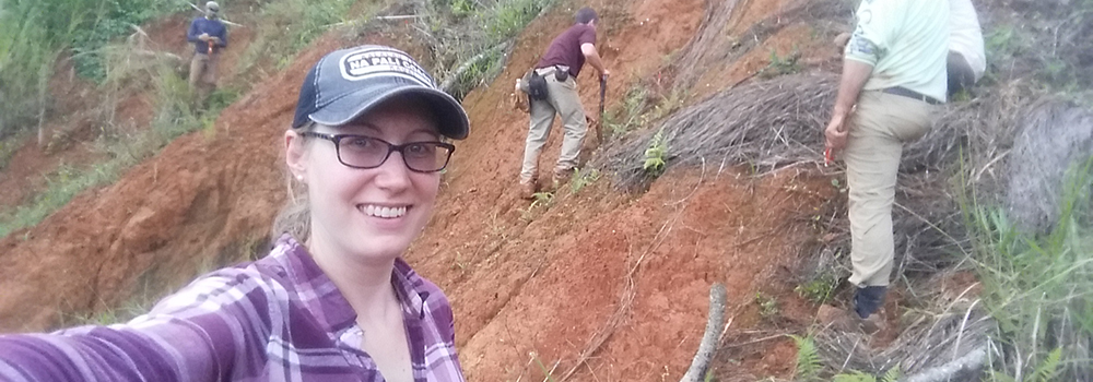
 Lindsay Davis on a site visit to Puerto Rico with the U.S. Geological Survey landslide team. ©Lindsay Davis, 2018.
The devastation caused when Hurricane Maria hit Puerto Rico in 2017 included nearly 40,000 landslides and highlighted the need for materials to help educate residents and emergency managers about landslide risk—especially those to address the challenges of the built environment. That need is being filled, thanks to a new partnership between the U.S. Geological Survey National Landslide Hazard Program and the Natural Hazards Center.
“After Hurricane Maria, professionals in Puerto Rico reached out to USGS for technical and educational materials on landslides,” said Lindsay Davis, a Natural Hazards Center Research Associate working on the project. “A lot of things contribute to landslide risk in Puerto Rico that go beyond what can be solved by citizen education. They require structural changes. Partnerships like this that work directly with stakeholders move the ball forward on ways to address complex issues.”
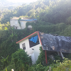
 A house in Utuado, Puerto Rico, after being dislodged by a landslide after Hurricane Maria. ©Lindsay Davis, 2018.
The Center, with support from USGS, recently appointed Lindsay Davis for the two-year project, which will work to decrease landslide risk in Puerto Rico. Davis, who is bilingual and has a background in geology and public policy, is serving as a liaison between the Center, USGS, and the Puerto Rico Planning Board to produce the much-needed outreach materials on landslides.
Because it is important that the materials reflect the culture and geology of the island, Davis has begun building a network and initiating collaborations with a multitude of stakeholders in Puerto Rico, including emergency managers and mitigation planners. Her work will focus on crafting guides that educate residents and on ways to reduce life and infrastructure losses from landslides. The material created will complement research maps and other resources currently being developed by the USGS and University of Puerto Rico Mayagüez.
“While the idea of the project is to produce materials to educate citizens and professionals about landslide risk, I hope we can use these outreach materials to start a conversation about landslides and how they relate to the broader picture of disaster risk reduction in Puerto Rico,” Davis said.
Davis comes to the Natural Hazards Center after spending a year as the Geological Society of America Science Policy Fellow in Washington D.C. During her graduate studies in the Peace Corps International Program at Michigan Technological University, Davis conducted anthropological research on rural disaster risk in the highlands of El Salvador, earning a Master of Science degree in geology in 2016. After graduating, she spent eight months in the Philippines working with community leaders, municipal planners, and emergency managers on disaster risk reduction. Davis has nearly ten years of experience working in natural hazards and international development. She specializes in using participatory and interdisciplinary methods to address complex problems related to natural hazards.
“We are very fortunate to have Lindsay at the Natural Hazards Center,” said Center director Lori Peek. “She brings a wealth of knowledge, a real dedication to disaster risk reduction, and a deep respect for the people of Puerto Rico. We are thankful for her work and for the support from the U.S. Geological Survey to move science into action.”