Burned Area Emergency Response Teams
Interactions and Opportunities During Southwestern Monsoon Seasons
Publication Date: 2022
Executive Summary
Overview
Post-fire flooding has become an increasing concern for public safety, particularly in the U.S. Southwest where monsoon precipitation can cause destructive floods and debris flows. Federal land management agencies often assemble interdisciplinary teams—called Burned Area Emergency Response or BAER teams—to assess risk and conduct rapid restabilization efforts to minimize post-fire flooding in burned areas. Restabilization efforts conducted by BAER teams are time sensitive due to precipitation forecasts and rely on effective communication between an assortment of different agencies, governments, organizations, and communities. Here, we present a pilot study investigating social perspectives on BAER, with a focus on weather-ready decision-making related to monsoon precipitation in Arizona and New Mexico. In this study, weather-ready decision making refers to proactive planning and management of forecasted weather impacts in the areas surrounding burned areas by land management agencies and their collaborators.
Research Questions
This study will address three research questions:
- How do BAER team efforts vary in the Southwest compared to other regions of the U.S.?
- To what extent do BAER teams interact with non-federal partners to inform weather-ready responses?
- How might climate change affect (or not affect) BAER team operations in the future?
Research Design
We conducted semi-structured interviews with 21 BAER team members and their non-federal partners about how BAER work intersects with the Southwestern monsoon season, and the role public communication and partnerships play in effective risk mitigation. Interviewees were identified through theoretical sampling via BAER reports published between 2016-2021, combined with snowball sampling conducted at the end of each interview. Interviews were recorded, transcribed, and qualitatively coded using an iterative coding process in analysis software NVivo.
Findings
Initial findings highlight the unique challenges that Arizona and New Mexico face in post-fire environments. Monsoon season in the Southwest creates temporal restrictions for proactive post-fire mitigation to protect life and property, underscoring the value of timely, informed BAER assessments and rapid implementation of recommendations. Interviewees described challenges associated with public communication; a small but growing portion of the public are aware of the work BAER teams conduct, but this often comes with assumptions about complete eradication of post-fire risk. BAER teams are increasingly forging partnerships with non-federal and local organizations and governments to combine resources and exchange information. This dissemination of knowledge helped interviewees support cross-boundary planning for post-fire flood risk, overcoming some of the limitations to BAER’s focus on federal land. Climate change presents a considerable challenge for “weather-ready” planning and mitigation conducted by BAER teams. Interviewees anticipate more unpredictable monsoon seasons that include more extreme dry and wet spells. This may narrow the already short window for post-fire emergency restabilization. Projected shifts related to climate change are compounded in modelling that helps to inform BAER efforts; localized preferences for models are identified as important given the varied conditions that fires occur in and create, but some of the data input into those models are limited as climate continues to shift.
Practical Implications
We draw several practical implications from this pilot study, including:
- BAER team members need more structured training on public communication.
- Partnerships between federal BAER agencies and local governments, organizations, and groups enhance public safety.
- Information sharing and discussions between federal and local partners improves planning and risk management across jurisdictional boundaries.
- Clearer guidance on models incorporated into BAER assessments, including the strengths and weaknesses of different approaches, is needed from leadership and research branches within federal land management agencies, such as the U.S. Forest Service’s research facilities (e.g., Rocky Mountain Research Station) and the U.S. Geological Survey.
- A federal initiative is needed to study how BAERs will be affected by climate change and update team operations based on these findings.
Introduction
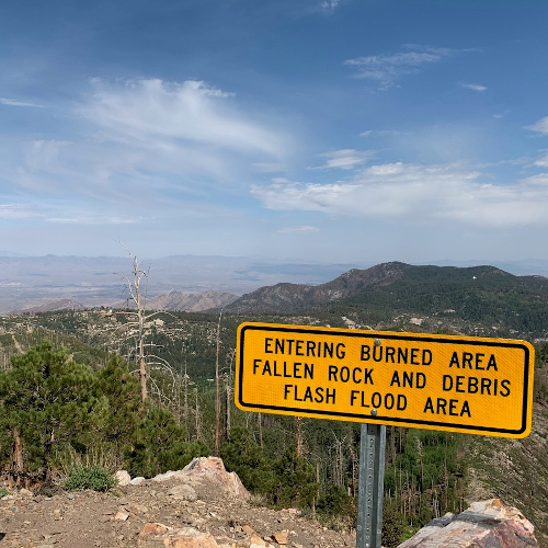
Extreme heat from wildfires can cause soil to become water repellent or hydrophobic, which prevents absorption and increases runoff during extreme rainfall. Peak flow can increase as much as 9600% after intense rainfall events on burn scars in the Southwest (Anderson et al., 19761; DeBano et al., 19982). These flash flood events can severely affect communities downslope from burned areas, causing loss of life, damage or destruction of property, and public health issues associated with water pollution (Bladon et al., 20143; Balfour et al., 20144; Garfin et al., 20165). Post-fire flooding is particularly prevalent in Arizona and New Mexico where the number, size, and intensity of wildfire events are on the rise and sudden-onset monsoons act as catalysts for catastrophic post-fire flooding.
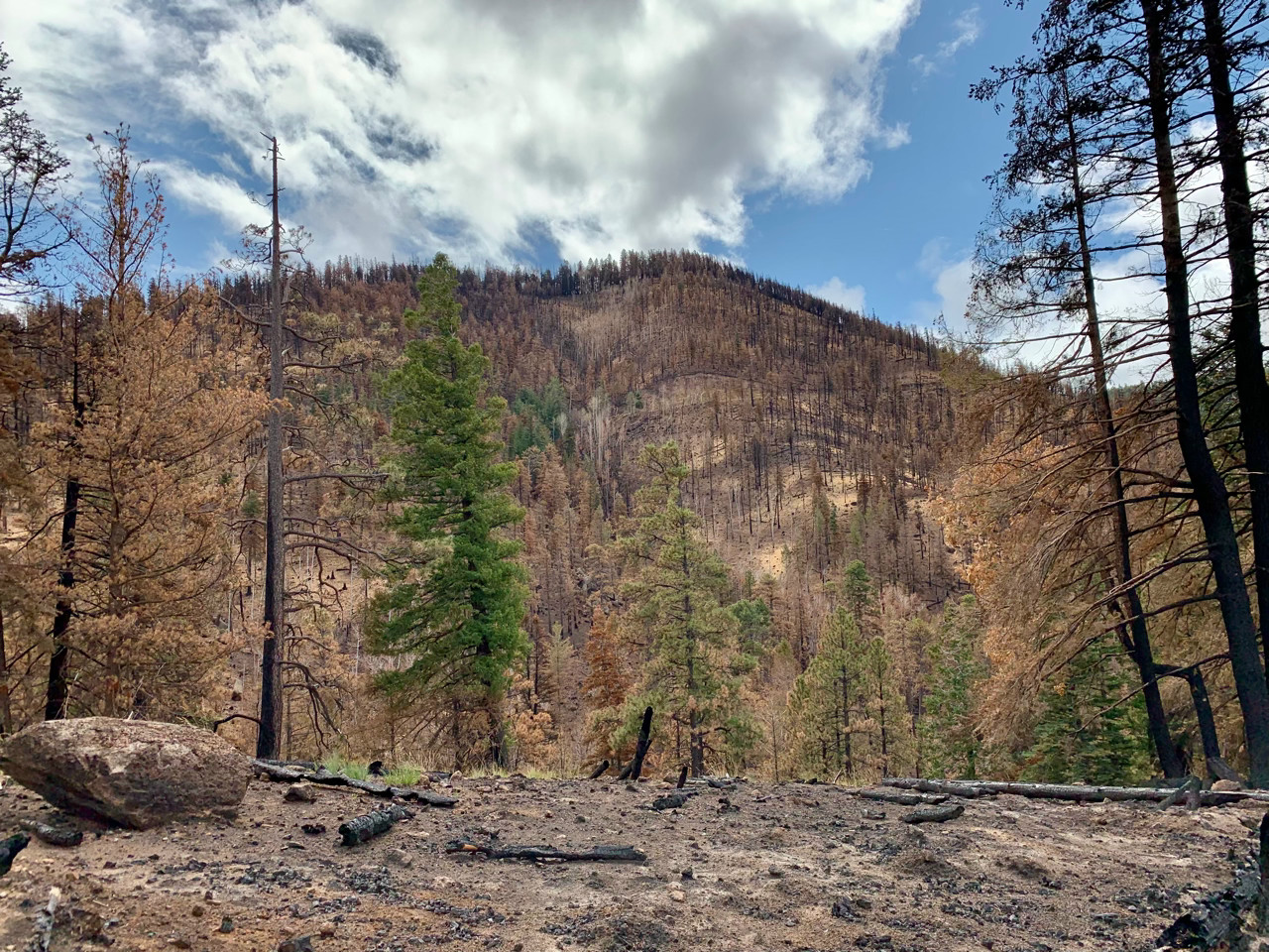
Federal land management agencies often assemble interdisciplinary teams—called Burned Area Emergency Response or BAER teams—to assess risk and conduct rapid stabilization efforts to minimize post-fire flooding in burned areas (see Figure 1 for an example). The BAER program is Congressionally funded and spans numerous federal land management and weather-focused agencies, including the U.S. Forest Service (USFS), National Park Service, Bureau of Land Management, U.S. Fish and Wildlife Service, Bureau of Indian Affairs, and U.S. Geological Survey (USGS). The National Weather Service (NWS) often partners with BAER teams from these agencies to forecast conditions in the burned area that can help inform their decision-making. Together, these agencies work to identify and address imminent threats on federal land after fire, with a focus on the potential for flooding and debris flows to be triggered by extreme rainfall events (Evans, 20166). Notably, BAER teams are tasked with mitigating post-fire risks on federal land; they have no authority to work on private lands, although they may be able to coordinate with non-federal agencies and land managers to align their efforts across jurisdictions.
Figure 1. Burned Area Emergency Response Restabilization Efforts on Slopes Burned by the 2019 Museum Fire
Motivating and leveraging similar mitigation activities on adjacent non-federal land offers an opportunity to extend weather-ready mitigation efforts across larger scales and diverse jurisdictions. This requires the identification of current practices, including challenges and opportunities to BAER operation, and a clearer idea of how BAER response may or may not evolve due to climate change. Collectively, social efforts to research BAER work can create opportunities for increased public safety in downslope areas and strengthen cooperation under time-sensitive conditions in future post-fire environments.
The pilot study outlined below aimed to investigate these social perspectives on BAER, with a focus on “weather-ready” decision-making related to monsoon precipitation in Arizona and New Mexico. This study will provide a foundational social understanding of weather-ready communication to manage burned landscapes.
Literature Review
A wealth of research exists on the biophysical components of post-fire precipitation interactions (for examples, see Robichaud et al., 20007; Hudak et al., 20118; Moody et al., 20139). Little is known, however, about how BAER teams and their partners make decisions and coordinate actions in the event of extreme precipitation being forecasted. Prior research on this topic has focused on model design, development, and implementation as a proxy for human decision-making or a tool for informing decision-making rather than focusing on human decision-making processes themselves (e.g., Robichaud, 200510; Robichaud et al,. 200711; Foltz et al., 201012; Miller et al., 201613). Deeper examination of how BAER team members and their partners interpret weather-forecasts and other climate conditions and translate that information into decisions is warranted. Currently, the federal government provides no formal guidance to BAER teams on this topic.
Post-fire responses undertaken by BAER teams generally address and prioritize protection of values at risk, which often include communities (Robichaud et al., 201414). BAER teams are only able to operate on federal land, meaning that communicating effectively with adjacent landowners is critical to support landscape-level risk reduction ahead of the next rainfall event (Kuyumjian, 200415). Furthermore, BAER teams may consist of federal employees from other parts of the United States who, as outsiders, may struggle to rapidly identify partners to work with on preparation for potential post-fire flood events. Existing research on cross-boundary management and collective action indicates that recruiting a diversity of landowners, experts, and stakeholders can result in more responsive, context-specific risk mitigation (Cyphers & Schultz, 201916)—qualities that are favorable for sudden onset precipitation events after wildfire. Establishing local and federal BAER partnerships can also enhance adaptive capacity in communities affected by wildfire events (Plummer & Armitage, 201017). Understanding how cross-jurisdictional partnerships or coordination can extend and ensure the success of flood mitigation strategies in areas impacted by fire offers many fruitful avenues for collaborative research and management.
A recent review of BAER responses from 1974 to 2009 indicated that there was high variability in the degree to which BAERs acknowledged or incorporated local values and concerns in their decision-making (Robichaud et al., 2014). Moreover, prior research does not provide specific guidance on how this finding can be applied in the field to strengthen response; nor does it examine how local weather forecasts informed BAER’s place-specific decision-making. It does, however, indicate that starting at a more localized or regional scale is beneficial for gaining depth of understanding rather than breadth.
Existing wildfire social science studies demonstrate that hazard mitigation is most effective at the community scale (Paveglio et al., 200918; 201519). Other efforts note that community members seek hazard information from trusted sources, such as local fire departments, community organizations, and local governments (Paton, 200820; Absher & Vaske, 201121; Steelman et al., 201522). These findings indicate that partnerships with representatives or experts from these place-specific non-federal groups have the capacity to enhance meaningful weather-ready communication to targeted populations after fires.
To the best of our knowledge, no existing research has focused on the social dimensions of BAER teams and their local collaborators (e.g., local and state governments, non-profit organizations, private landowners); however, communication between these groups for weather-ready responses is one of the most integral needs of these federal teams as their success often relies on effective translation of weather forecasts into on-the ground risk reduction. Concurrent rapid development and dissemination of “weather ready” information provided to BAER teams contributes to the social-ecological resilience of local landscapes and embedded communities at risk (Berkes et al., 200823).
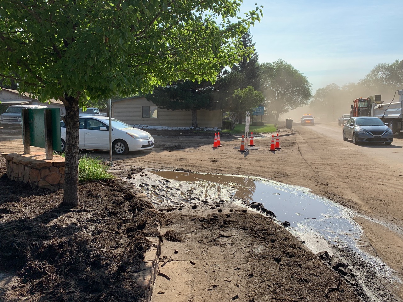
Findings from this study can improve agency connectivity to advance weather-ready risk mitigation after fire nationally, while also improving cross-boundary collaboration for flood risk management in the future. It may also generate additional guidance for weather professionals regarding how their forecasts are used, so that communication can be better tailored for post-fire decision-making by BAER teams. Social components of post-fire flooding remain severely under-researched on an international scale. Proactive adaptation of findings in this study will benefit areas affected by wildfire and potential post-fire flooding in the future as large-scale secondary flood events in or near residential areas like those following the 2010 Schultz Fire and 2019 Museum Fire in Arizona (Figure 2), the 2011 Las Conchas Fire in New Mexico, and the 2017 Thomas Fire in California become increasingly common.
Figure 2. Road Closures Caused by Post-Fire Flood in Flagstaff, AZ
Methods
Research Questions
To address the knowledge gaps identified above, we sought to answer the following research questions:
- How do BAER team efforts vary in the Southwest compared to other regions of the United States?
- To what extent do BAER teams interact with non-federal partners to inform weather-ready responses?
- How might climate change affect (or not affect) BAER team operations in the future?
Study Area
The varied topography and sudden-onset monsoon rains of the U.S. Southwest are conducive to severe post-fire flooding caused by run-off from recent burn scars; this means that BAER team members in the Southwest are among the most experienced nationally regarding weather-focused planning. We focused our data collection efforts on Arizona and New Mexico to ensure that we can gather experienced insights that are directly relevant to extreme precipitation events. Post-fire flooding has become a predominant issue in this region, with recent destructive post-fire flooding events documented after the 2010 Schultz Fire (Arizona), 2019 Museum Fire (Arizona), 2011 Las Conchas Fire (New Mexico), 2012 Little Bear Fire (New Mexico), and 2021 Telegraph Fire (Arizona) among others. Many communities are taking proactive measures to reduce the likelihood of post-fire flooding, including cities like Williams, AZ, for which the U.S. Forest Service and their partners have invested millions of dollars into watershed restoration.
Approach
Data collection and analysis for this study consists of three efforts: (1) a content analysis of current guidance for weather-ready communication in post-fire environments, (2) geospatial analysis of secondary data from BAER reports, and (3) semi-structured interviews with BAER teams and non-federal partners to examine current weather-ready communication and areas for improvement. Our study design was informed by five key informant interviews with BAER experts in the Southwest. This Quick Response Report focuses exclusively on interview data given limited space and the value of clearly communicating the rich detail that interviews provided.
Interviews followed a semi-structured protocol containing questions that investigate core themes related to our research questions, including: (1) Interviewee experience with BAER; (2) challenges and opportunities for BAER work in the Southwest; (3) current collaborations between federal and non-federal land owners and managers to address post-fire flood risk; and (4) expected impacts (or lack thereof) to post-fire flooding and related BAER work under climate change. Probing questions were deployed to identify and expand upon emergent themes to gain a greater depth of understanding about specific communication needs and challenges. Interviews were audio-recorded with the permission of each participant.
We have conducted a total of 21 interviews to date (including key informant interviews), with more planned for spring 2022. Interviews lasted between 40 and 77 minutes, with an average length of 61 minutes. All interviews were conducted via Zoom or phone. Limited availability of interviewees due to the 2021 fire season and COVID-19 mean that we consider the results provided below a “pilot" effort that is currently being expanded on.
Sampling Strategy
We focused our participant recruitment efforts on individuals engaged with BAER work across Arizona and New Mexico in the past five years, which cumulatively have seen 71 fires that necessitated some level of BAER assessment. To begin, names of BAER team members listed in BAER reports were compiled, including each individual’s job title and/or role in the BAER team. We noted that there is considerable overlap, with many individuals participating in multiple BAER efforts during this period. Contact information for those individuals was then collected; this assisted with additional parsing down of the data, as some had retired or moved on to new jobs with other agencies or organizations where BAER was not a position responsibility. This process, known as theoretical sampling, created a list of federal employees to contact, as well as a small number of non-federal partners to begin contacting. This pilot included 16 interviewees from USFS and five from non-federal partners (predominantly representing state agencies and local governments). Interviewees had diverse experiences with BAER teams, ranging from leading BAER efforts on multiple fires to providing support to, or receiving data from, BAER teams. Some interviewees had engaged with the BAER program for more than 30 years, while others had less than a year of experience. Forthcoming interviews will focus on interview recruitment across additional federal agencies.
We reached out to the resultant list of BAER potential participant to invite them to participate in this study via email and/or phone depending on contact information availability. Multiple contact attempts were made for each person. At the end of each interview, we asked the participant for suggestions of other individuals to interview outside their organization in a process known as chain referral or snowball sampling (Biernacki & Waldorf, 198124). This was particularly valuable for identifying non-federal partners. Interviews are ongoing, but will cease once theoretical saturation has been reached (Charmaz, 200625).
Data Analysis
Upon completion of data collection, each recording was transcribed verbatim. Transcripts were analyzed using qualitative analysis software NVivo to develop descriptive and thematic codes. Given that no research has been conducted on this topic, we implemented an iterative coding process that helped develop grounded theory using both analytic induction and thematic analysis (Glaser & Strauss, 196726; Ryan & Bernard, 200027). Finally, we identified representative quotes for each theme.
Preliminary Findings
Characterizing Burned Area Emergency Response in the Southwest
Interviewees spanned several agencies and organizations engaged in post-fire work in or adjacent to BAER teams, including the USFS, state agencies, local government, and non-governmental organizations. Their experiences were diverse, ranging from a little over a year to several decades working in or with BAER teams. Many had worked with or for organizations engaged in BAER in several areas of the United States due to internal promotion within their agency or organization, or an absence of expertise in other regions that required external assistance. That geographic diversity of experiences allowed interviewees to identify significant differences regarding the relationship between BAER and weather forecasting in the Southwest. The most notable difference was monsoon rain, which dictated how interviewees planned for and communicated about post-fire flood risk:
We have a monsoon season. It starts in July, it goes through end of August. That’s when you’re going to be at risk. You don’t see a lot of post-fire impacts related to snow melt, things like that. So it helps you—especially in communicating with people—it helps you kind of focus down to, the critical timeframe is that monsoon.
The monsoon season was frequently referred to as the most useful window for identifying when BAER teams would be urgently needed in Arizona and New Mexico. These often-intense precipitation events drove the “time sensitive” nature of assessing burned areas and implementing recommendations. One interviewee explained how protecting values at risk complicated BAER team approaches, narrowing that window of opportunity even further:
Well, it certainly puts a time constraint on you... especially if it's a big complex incident where you've got the city of Tucson, the city of Flagstaff at risk, you often start with kind of a backwards counting from, let's just say July fourth. That's the onset of monsoons. Figure it's going to take a week to do this, week to do that, two weeks to do anything. That means you've got to have your report done by June 17th, if you're to have any chance of implementing any treatments that could be meaningful and effective.
The nature of monsoon rains meant that opinions on the value of weather forecasting for BAER work and potential flood risk varied among interviewees. One federal interviewee explained why forecasting did not affect their own approach to BAER work:
Personally, I don't put a lot of stock in a long-term forecast after a fire. Because my experience is, I guess from a practical point of view: it will rain. It might happen tomorrow, it might happen next week, it might happen next month, but it will rain. And now the challenge is defining, is there anything reasonable to do to address the risk that has been identified to a value? If you're lucky it doesn't rain for a year, you've got all that time to get prepped and ready. But like I said, I've seen it rain within a week of the start of a BAER assessment. I've seen it rain within hours after finishing a BAER assessment. So, you know it's going to happen; what you don't know is when.
Communicating With the Public and Non-Federal Partners About Burned Area Emergency Response
Interviewees consistently identified communication with the public about BAER team efforts as a challenge. To begin, few had received any form of training about communication in high-stress environments after fire, or the best way to share information with lay people. Instead, most described shadowing a mentor or more experienced individual:
I've never had any formal training. I've learned a lot from watching and participating in evening briefings, public meetings with various incident command teams, and just, I guess what I took away from them is I tried to develop some skillset in communicating with people. You've got to be confident. You've got to be honest and you've got to be able to say “I don't know,” you know… Just kind of point blank give them the facts, don't embellish it with a lot of speculation. Tell them “I don't know the answer to that” when you don't know and try to help, follow-up and give them an answer at some point in the near future.
Interviewees who had more experience presenting BAER work to the public in these environments emphasized being transparent about their work and the limits to restabilization actions in burned areas. Participants who had worked with BAER for an extended period of time noted that public understandings of what BAER is and how it works has increased in the past decade or so; however, the most common misconception was that BAER work would eradicate post-fire flood risk, as one interviewee explained:
It's that comfort—even though it might be a false comfort—in seeing actions being done on the ground that maybe says, "Okay, they're doing something up there, we’re safe." And that's the farthest from the truth. What we preach is that there's always going to be risk after a fire, no matter what. Now, there's nothing that we can do, nothing… if a big storm comes that's going to hold back erosion and flooding and those sorts of things. I think it's one of those where when we do treat, people may feel a little safer because we're doing something, but the message really is: Nope, there's still risk here. Everyone needs to still be vigilant, that anything could happen.
A core challenge to transparent communication with the public was uncertainty regarding the various models BAER teams use to analyze potential flood and debris flow outcomes. The kinds of modelling approaches varied regionally and depending on what BAER team leaders or experts were most comfortable with, meaning that there has been no singular approach to examining potential flooding risk after fire in the Southwest. One interviewee explained the benefits and challenges of localized modelling approaches:
I think the model you use needs to be tuned to the area you're working in, the data you have available and the scope and complexity of what you're dealing with and a bunch of knowledge.
Another interviewee expanded:
That comes up all the time. Which model is the best one?... what we try to present is the pros and cons of each of the models. And then the BAER teams kind of decide which ones they should use for a given condition. We purposely try to be, as scientists, we try to be objective as to pros and cons of our models and let the BAER to teams decide what they want to use for a given condition or a given geographic region, et cetera.
Beyond which model to use, discussions also centered around which precipitation event was the right one to model in order to identify appropriate implementation strategies. What had previously been identified as standard approaches were increasingly being challenged by climate change and an increased number of unusual precipitation and flood events:
Depending on the storm occurrence or frequency that we're modeling, which we're usually trying to model something that's likely to happen in the next year or next three years, right? Something for BAER, that immediate risk. We usually look at those five- or 10-year events. But now what we're seeing with climate change where, yeah, you can get the 500-year events, right? … It comes down to discussions, I guess internally, about what is the right storm to model for a given region? Because you also don't want to oversell the risk, saying, "1000-year storms coming." I guess it's all about the probability.
Uncertainty around modelling prompted many BAER teams to foster closer connections with local partners. Those partners often had access to longitudinal data and risk modelling funded prior to a fire event, providing additional information that assisted BAER teams in making more informed decisions. Several interviewees described a recent increase in these kinds of partnerships that improved BAER response:
What I saw in the [name] Fire was a kind of collaboration that I haven't seen before, where we did have folks from [local organization] actually sit in on the team and help us. They had some local knowledge of this area because they had done some kind of pre-emergency monitoring from... maybe 2017 or something like that. They had already modeled some of these areas for the County for this exact scenario… that did help with where we put these rain gauges... They got to see the whole BAER process, and hoping that gave them a little more understanding of what, again, what we can do in there and where our limits are.
Recognizing the value of federal-local partnerships for effective BAER work, some interviewees described intentionally developing practices that enhance the ability of their partners to improve weather-ready decision-making. This could be as simple as extending modelling efforts beyond federal boundaries, as one interviewee described:
The other thing that I've worked really hard to do is be very transparent in my data and sharing my information, and in part it's to compensate for the fact that we can no longer do treatments to benefit off-forest resources. So it's a way for me to show that the Forest Service does actually care about what happens to you… If I can't do treatments to help you, at least I can give really good data to give you a leg up.
Interviewees with more experience often observed that the role of ongoing local politics around federal land management also played into the success of BAER teams in any given location. Regardless of the success of federal-local partnerships, decisions on whether to act on BAER team assessment recommendation often fell to one person. One interviewee summarized:
Sometimes there are issues or conditions that you're not aware of from a social or political perspective that does tend to hinder or slow down a review process, a signature. I've had instances where you spend the 30 minutes giving your briefing to a line officer and they picked up the pen at minute 24 and they're ready to sign. Others have pushed it back across the table and said “I'd like you to look harder at this particular question or that particular recommendation, give me some more options, a different option,” … You just never know who's talking in that person's ear and what their schedule is like.
That political climate might limit the speed or scope of weather-ready action to support post-fire risk reduction. Some interviewees indicated that navigating local politics was one of the most prevalent challenges to working on a fire outside of their home region or forest. These conditions increased the complexity of BAER work, meaning that new BAER team members earned the most beneficial training by shadowing more experienced individuals in the field:
You know, I have worked with a number of people who've done a lot more of this and a lot more complex physically, socially complex incidents… You learn from folks who are more knowledgeable, who have seen more, who have more of a knowledge base to draw from.
Adapting Burned Area Emergency Response to Address Climate Change
Interviewees identified numerous opportunities and challenges for BAER moving forward that intersect with climate change. When asked how climate change might impact BAER operations, many indicated that they expected monsoon seasons in the Southwest to become increasingly unpredictable. That might prove increasingly challenging given BAER’s reliance on modelling using past data to determine potential outcomes:
The data that we operate off of are these 30-year averages. And as those get updated, our model should update as well. And it's hard to sometimes model for what we're seeing. With climate changes, and I think what the predictions are is that more years of dryness followed by a year or whatever it might be of these really intense really focused rains, where you get it all at once and then it's dry the rest of the year. I think it's something to be aware of… [we’re] not looking for those precise numbers, we're looking for that magnitude of change.
When monsoon seasons arrive, others felt that this would result in even greater risk and urgency related to BAER work:
I do think in the Southwest that the monsoon pattern might get even stronger. That's one concern I have. If we had a warmer monsoon pattern and more convective storms coming in, particularly with the orographic effect that you have in Northern Arizona, I could see where you could get more severe events.
The potential impacts that climate change may have on BAER work underscore the importance of continuing to establish meaningful partnerships that improve public safety. Many saw these partnerships as a chance to better facilitate early warning system development related to unusual precipitation and potential flood events. One interviewee described how this might work in partnership with the National Weather Service, highlighting how the responsibilities of USGS, NWS and USFS complement each other:
How it usually works internally for the Forest Services is: we're doing the environmental clearances, which is usually a short and sweet categorical exclusion, that's saying, " Yes, you can use this piece of land for an early alert system." So, we're kind of given the okay for that early alert system to be on the Forest Service land, because we're usually at the top of the watershed. And then another entity, normally the National Weather Service is responsible for putting those early alerts out.
Another interviewee expanded this further to highlight the benefit that early warning systems will provide communities under climate change:
When we see this climate change and these bigger storms, maybe less frequently, having those early alert systems in place will help us with that. Because what those do is, as we get a certain amount of rain and a certain amount of timeframe, that's when those early warnings become active. And so, if you do see those huge storm events coming, you can capture that with one of these early alert systems… Potentially, you could be modeling bigger storms, but I think that's a case to be made for the regional office and the Washington office that are approving some of these BAER reports.
Conclusions
Summary of Key Findings
Interviews with BAER team members and non-federal partners highlight the unique challenges that Arizona and New Mexico face. Monsoon season in the Southwest creates temporal restrictions for proactive post-fire mitigation to protect life and property, underscoring the value of timely, informed BAER assessments and rapid implementation of recommendations.
Interviewees described challenges associated with public communication; a small but growing portion of the public are aware of the work BAER teams conduct, but this often comes with assumptions about complete eradication of post-fire risk. BAER teams are increasingly forging partnerships with non-federal and local organizations and governments to combine resources and exchange information. This dissemination of knowledge helped interviewees support cross-boundary planning for post-fire flood risk, overcoming some of the limitations to BAER’s focus on federal land.
Climate change presents a considerable challenge for “weather-ready” planning and mitigation conducted by BAER teams. Interviewees anticipate more unpredictable monsoon seasons that include more extreme dry and wet spells. This may narrow the already short window for post-fire emergency restabilization. Projected shifts related to climate change are compounded in modelling that helps to inform BAER efforts; localized preferences for models are identified as important given the varied conditions that fires occur in and create, but some of the data input into those models are limited as climate continues to shift.
In sum, BAER teams working in the Southwest are at the forefront of climate change-related challenges that require attention to protect life and property during extreme precipitation events over burned areas.
Practical Implications
Initial findings from this study allow us to make several recommendations regarding support of BAER teams and their partners moving forward.
- Training on public communication: Many interviewees highlighted that most of their BAER training was informal and gathered in the field while on assignment. However, some aspects of BAER work—specifically, public communication—is challenging to learn via trial and error in the field. More intentional efforts to support development of these skills can help communicate BAER work clearly to different audiences and relieve some of the pressure on new BAER members to navigate their own path to communicating complex topics such as model uncertainty.
- More intentional support for BAER teams to collaborate with non-federal partners: Interviewees shared numerous instances where organic partnerships with non-federal organizations allowed the development of more proactive, informed plans for public safety during future precipitation events. Incentivizing BAER team members to build these collaborations and informing non-federal entities about the benefits of engaging with BAER can support more seamless mitigation and planning across jurisdictions. This may be as simple as compiling a list of recent local modeling efforts related to hydrology and fire with the main contact for each dataset.
- A need for clearer guidance on models: Many interviewees spoke about ambiguity in modelling, with most adopting the approach they were taught during completion of a degree, trainings, or what their agency mentor was most comfortable with. Outlining differences between common models, including their strengths and weaknesses, may open op opportunities for the identification of new models that may complement or extend existing approaches.
- Growing need for a strategy to address climate change impacts on BAER: Related to the point above, models are beginning to run up against limitations based on availability of future projections and uncertainty about future conditions. Communication and decision-making in post-fire environments may benefit from agency-level guidance to tackle this. Additionally, changes in monsoon precipitation influenced by climate change may necessitate shifts in the way BAER responds in the Southwest; that could include greater weighting of rapid assessment techniques to allow assessments and implementation to begin to occur concurrently, or some other organizational approach that is adapted to the more erratic nature of future monsoons.
Limitations
This effort introduces preliminary themes for “weather-ready” BAER work in the Southwest. However, we have not yet been able to complete snowball sampling for this work as data collection is still in progress; therefore, some themes may shift or expand as more information is gathered. Additionally, we emphasize that themes identified here may not be representative of BAER work in other regions of the United States.
Future Research Directions
Our goal is to continue interviewing additional participants until snowball sampling for the Southwest concludes. Upon completion, dissemination will take the form of a white paper or fact sheet and a manuscript for consideration in a peer-reviewed journal. Additional research at the intersection of BAER and weather-ready activities could include the following:
- Examination of how different regions of the United States anticipate climate change impacting weather-ready approaches to BAER work;
- Case studies of successful BAER partnerships with non-federal entities; and
- Studies of public reception to BAER activities and communication in recently burned areas.
Now is an opportune time to dive deeper into the social components of BAER work; we encourage research that can support greater understanding of post-fire flood risk across boundaries while improving public safety and limiting negative social-ecological impacts.
References
-
Anderson, H. W., Hoover, M. D., & Reinhart, K. G. (1976). Forests and water: effects of forest management on floods, sedimentation, and water supply (Vol. 18). Department of Agriculture, Forest Service, Pacific Southwest Forest and Range Experiment Station. ↩
-
DeBano, L.F., Neary, D.G. & Ffolliot P.F. (1998). Fire’s effects on ecosystems. John Wiley & Sons. ↩
-
Bladon, K. D., M. B. Emelko, U. Silins, & M. Stone. (2014). Wildfire and the Future of Water Supply. Environmental Science & Technology, 48(16), 8936-8943. ↩
-
Balfour, V. N., S. H. Doerr, & P. R. Robichaud. (2014). The temporal evolution of wildfire ash and implications for post-fire infiltration. International Journal of Wildland Fire, 23(5):733-745. ↩
-
Garfin, G., S. LeRoy, D. Martin, M. Hammersley, A. Youberg, & R. Quay. (2016). Managing for Future Risks of Fire, Extreme Precipitation, and Post-fire Flooding. Institute of the Environment, University of Arizona. ↩
-
Evans, A. (2016). 2015 Wildfire Season: An Overview, Southwestern U.S. Ecologcial Restoration Institute and Southwest Fire Science Consortium, Northern Arizona University. http://www.swfireconsortium.org/wp-content/uploads/2016/08/2015-Wildfire-Season-Overview_FINAL-2.pdf ↩
-
Robichaud, P. R., Beyers, J. L., & Neary, D. G. (2000). Evaluating the Effectiveness Of Postfire Rehabilitation Treatments. United States Forest Service. https://www.fs.usda.gov/treesearch/pubs/23617 ↩
-
Hudak, A.T., Rickert, I., Morgan, P., Strand, E., Lewis, S.A., Robichaud, P., Hoffman, C. & Holden, Z.A. (2011). Review of fuel treatment effectiveness in forests and rangelands and a case study from the 2007 megafires in central Idaho USA. United States Forest Service. https://www.fs.fed.us/rm/pubs/rmrs_gtr252.pdf ↩
-
Moody, J. A., Shakesby, R. A., Robichaud, P. R., Cannon, S. H., & Martin, D. A. (2013). Current research issues related to post-wildfire runoff and erosion processes. Earth-Science Reviews, 122, 10-37. ↩
-
Robichaud, P. R. (2005). Measurement of post-fire hillslope erosion to evaluate and model rehabilitation treatment effectiveness and recovery. International Journal of Wildland Fire, 14(4), 475-485. ↩
-
Robichaud, P. R., Elliot, W. J., Pierson, F. B., Hall, D. E., & Moffet, C. A. (2007). Predicting postfire erosion and mitigation effectiveness with a web-based probabilistic erosion model. Catena, 71(2), 229-241. ↩
-
Foltz, R. B., Robichaud, P. R., & Rhee, H. (2009). A synthesis of post-fire road treatments for BAER teams: methods, treatment effectiveness, and decision-making tools for rehabilitation. United States Forest Service. https://digitalcommons.unl.edu/cgi/viewcontent.cgi?article=1095&context=jfspresearch ↩
-
Miller, M. E., Elliot, W. J., Billmire, M., Robichaud, P. R., & Endsley, K. A. (2016). Rapid-response tools and datasets for post-fire remediation: linking remote sensing and process-based hydrological models. International Journal of Wildland Fire, 25(10), 1061-1073. ↩
-
Robichaud, P. R., Rhee, H., & Lewis, S. A. (2014). A Synthesis of Post-Fire Burned Area Reports From 1972 to 2009 for Western US Forest Service Lands: Trends in Wildfire Characteristics and Post-Fire Stabilisation Treatments and Expenditures. International Journal of Wildland Fire, 23(7), 929-944. ↩
-
Kuyumjian, G. (2004). The BAER team: Responding to post-fire threats. Southwest Hydrology, 3(5), 14-15. ↩
-
Cyphers, L. A., & Schultz, C. A. (2019). Policy design to support cross-boundary land management: the example of the Joint Chiefs Landscape Restoration Partnership. Land Use Policy, 80, 362-369. ↩
-
Plummer, R., & Armitage, D. (2010). Integrating perspectives on adaptive capacity and environmental governance. In D. Armitage & R. Plummer (Eds.), Adaptive capacity and environmental governance (pp. 1-19). Springer. ↩
-
Paveglio, T. B., Jakes, P. J., Carroll, M. S., & Williams, D. R. (2009). Understanding social complexity within the wildland–urban interface: a new species of human habitation? Environmental Management, 43(6), 1085-1095. ↩
-
Paveglio, T. B., Moseley, C., Carroll, M. S., Williams, D. R., Davis, E. J., & Fischer, A. P. (2015). Categorizing the social context of the wildland urban interface: Adaptive capacity for wildfire and community “archetypes”. Forest Science, 61(2), 298-310. ↩
-
Paton, D. (2008). Risk communication and natural hazard mitigation: how trust influences its effectiveness. International Journal of Global Environmental Issues, 8(1-2), 2-16. ↩
-
Absher, J. D., & Vaske, J. J. (2011). The role of trust in residents’ fire wise actions. International Journal of Wildland Fire, 20(2), 318-325. ↩
-
Steelman, T. A., McCaffrey, S. M., Velez, A. L. K., & Briefel, J. A. (2015). What information do people use, trust, and find useful during a disaster? Evidence from five large wildfires. Natural Hazards, 76(1), 615-634. ↩
-
Berkes, F., Colding, J., & Folke, C. (Eds.). (2008). Navigating social-ecological systems: building resilience for complexity and change. Cambridge University Press. ↩
-
Biernacki, P., & Waldorf, D. 1981. Snowball sampling: Problems and techniques of chain referral sampling. Sociological Methods & Research, 10(2), 141-163. ↩
-
Charmaz, K. (2006). Constructing grounded theory: A practical guide through qualitative analysis. Sage. ↩
-
Glaser, B. G., & Strauss, A. L. (1967). Discovery of grounded theory: Strategies for qualitative research. Routledge. ↩
-
Ryan, G.W. & Bernard, H.R. (2000). Data management and analysis methods. In: N. K. Denzin & Y. S. Lincoln (Eds.), Handbook of qualitative research (2nd ed.) (pp 769–802). Sage. ↩
Edgeley, C., Haarmann, N., & Jaramillo-Scarborough, A. (2022). Burned Area Emergency Response Teams: Interactions and Opportunities During Southwestern Monsoon Seasons (Natural Hazards Center Weather Ready Research Report Series, Report 7). Natural Hazards Center, University of Colorado Boulder. https://hazards.colorado.edu/weather-ready-research/burned-area-emergency-response-teams-interactions-and-opportunities-during-southwestern-monsoon-seasons